Tuesday, April 30, 2013
May Outlook
Plan on a warmer than normal May in all areas of Utah with near normal precipitation for most areas, slightly below normal in the far northern areas.


Thursday, April 18, 2013
Snowpack - Utah Lake
See the below picture for how the last three years snow pack compares to normal for the Utah Lake/Jordan River drainage, most other basins in northern Utah will look similar.

Click on image to make bigger.

Click on image to make bigger.
Sunday, April 14, 2013
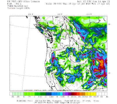
Back to winter!
A slow moving winter storm is expected to slowly move through Utah Monday through Wednesday with accumulating snow mainly above 5,000 ft, temperatures do get cold enough for snow down to around 4,000 ft at times. As of now plan on a general 6-12" of snow above 7,000 ft for most all Utah mountain areas with local 12-24"+ focused over the Uintas. See below for model projected snow fall through 6 pm Wednesday.
Monday, April 8, 2013
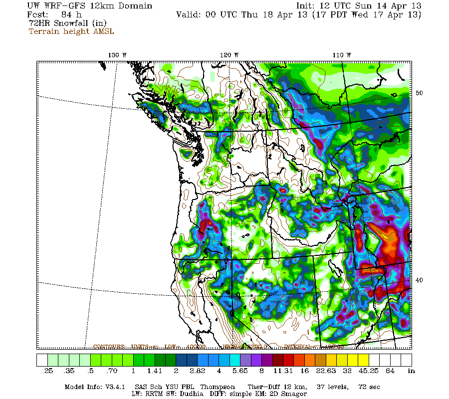
Strong Downslope/Canyon Winds - Snow
A strong storm is expected to move into Utah on Monday and continue into the day on Tuesday. Plan on areas of heavy snow focused over central/southern Utah mountains. Look for a general 6-12" of snow for most Utah Mountain areas above 7,000 ft with local 12-24" amounts. See the below map for model projected snowfall.

The other big story will be the strong downslope canyon winds focused in
Weber and Davis county with gusts of 70+ mph possible on Monday night
into the morning hours on Tuesday! Click on the below map for model projected wind speeds in knots for the Wasatch Front at 2am on Tuesday.


Subscribe to:
Posts (Atom)