Friday, July 18, 2014
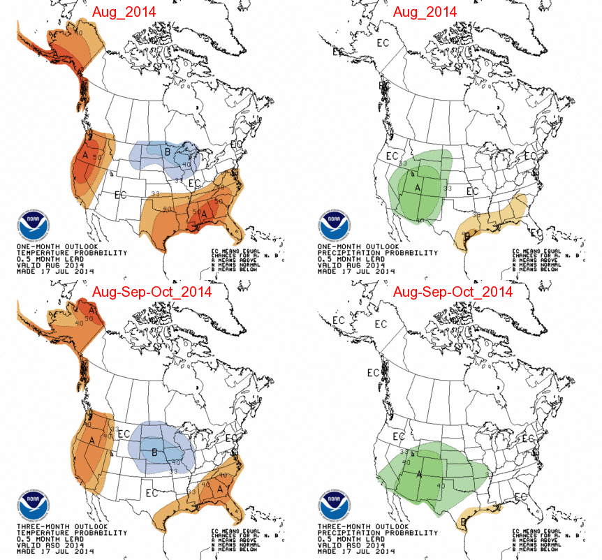
August Outlook
Plan on above normal precipitation for all of Utah in August with near normal precipitation.


Tuesday, July 1, 2014
June 2014 Climatic Summary
Click on the below link.
http://www.wrh.noaa.gov/slc/climate/CLM/June2014_Climatic_Summary.pdf
http://www.wrh.noaa.gov/slc/climate/CLM/June2014_Climatic_Summary.pdf
Friday, June 20, 2014
July Outlook
Plan on warmer than normal temperatures for the western half of Utah with above normal precipitation for most of Utah.

Sunday, June 1, 2014
May 2014 Climatic Summary
Click on the below link.
http://www.wrh.noaa.gov/slc/climate/CLM/May2014_Climatic_Summary.pdf
http://www.wrh.noaa.gov/slc/climate/CLM/May2014_Climatic_Summary.pdf
Friday, May 16, 2014
June Outlook
Plan on near normal temperatures for most of Utah with above normal precipitation for most areas except the southwest corner of the state.

Saturday, May 10, 2014
Significant spring snow!
Look for 20"+ of snow tonight through Sunday night in local central/eastern mountain above 8,000 ft including the northern slope of the Uinta mountains. Click on the below map for model projected snowfall for the storm.

Thursday, May 1, 2014
Friday, April 25, 2014
More spring snow - Lake effect?
Click on the below map for model projected snow fall through 6pm Monday, possible lake effect snow to the valley floors on Monday morning.

Tuesday, April 22, 2014
Spring snow - wind
Strong south winds today with gusts to 60+ ahead of a strong cold front that will bring a general 3-6" of snow to the Wasatch and Uinta mountains above 7,000 ft. Click on the below map for model forecasted snow amounts.

Thursday, April 17, 2014
May Outlook
In May look for warmer than normal temperatures in southern Utah with near normal temperatures for northern Utah, plan on near normal precipitation for all of Utah.

Subscribe to:
Posts (Atom)