New Focus
I'm now mostly a retired meteorologist but still love to watch Utah weather. I will continue to update the Utah weather cam images and Utah weather links pages and occasionally post Utah weather related information. I'm spending more time enjoying Utah snow skiing, cycling, hiking, and water skiing.
Saturday, January 31, 2015
Thursday, January 29, 2015
Good snow for central/southern Utah mountains
Valley rain and snow mainly above 6,500 ft will continue Thursday night over central/southern Utah, ending during the morning hours on Saturday. Plan on a general 3-10" of snow for most areas above 6,500 ft with local 10-18" for areas above 8,500 ft.
Monday, January 26, 2015
Record warmth, a little mountain snow! (15)
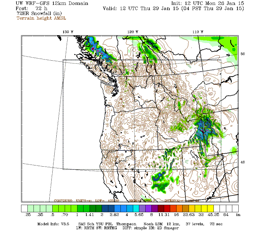
Look for record warm temperatures in the mountains today, a little spotty valley rain and light high mountain snow on Tuesday into Wednesday morning. Plan on 1/2-4" of snow in the central and northern Utah mountains above 8,000 ft. Below is the WRF Model forecast snow through 5am Thursday.
Thursday, January 22, 2015
Sunday, January 11, 2015
Average Utah winter storm (14)
Valley rain and mountain snow is expected to move into northern Utah on Monday morning, central Utah on Monday afternoon. The valley rain is expected to change over to snow with all snow ending over most areas of Utah by Tuesday morning. Plan on a general tr-2" of snow for the Wasatch Front valleys, 2-4" benches, 3-6" mountain valleys, 6-12" mountains above 7,000 ft. See below for WRF model forecasted snow for this storm.
Friday, January 9, 2015
Small mainly Central/Southern Utah Storm (13)
Plan on light lower valley rain and mountain snow on Saturday for mainly central/southern Utah with a general 1-4" of snow for mountain areas above 7,000 ft, local trace-1" of snow for valley areas above 4,500 ft. See below for model forecasted snow for this storm.
Friday, January 2, 2015
Thursday, January 1, 2015
Subscribe to:
Comments (Atom)


