Monday, January 27, 2014
Winter finally returns!
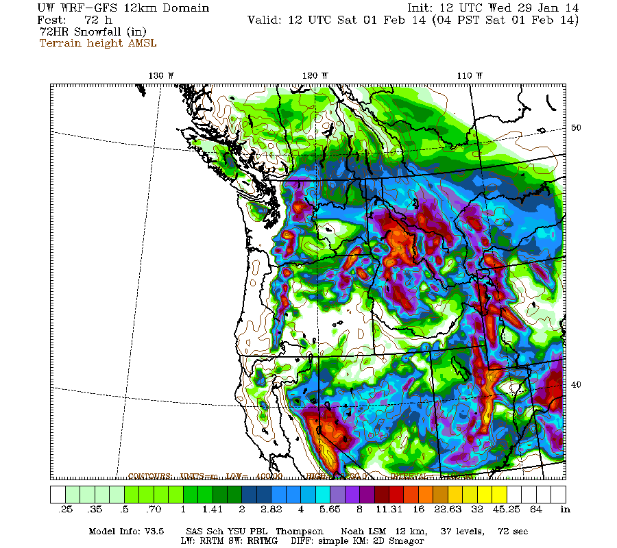
A storm (warm front initially) is finally expected to move into Utah on Wednesday and continue into the day on Friday, most of the snow arrives early on Thursday with the cold front in northern Utah then the front stalls over central/southern Utah on Friday with clearing in northern Utah. As of now plan on a general 10-20" of snow for most central and northern Utah mountains above 8,000 ft with 4-8" in the southern Utah mountains. Click on the below map for details.
Monday, January 20, 2014
Utah Snow Cover
Click on the below satellite picture to see the snow cover over Utah on January 20th.

Friday, January 17, 2014
February Outlook

Saturday, January 11, 2014
Last storm
Once more storm is forecasted to move into mainly northern Utah on Saturday night with snow continuing at times into Monday morning. In general plan on a trace-3" in the Wasatch front valleys, 2-5" for the benches, 5-8" for the mountain valleys, and 8-18" for the mountain areas above 7,000 ft. Click on the below image for WRF model forecasted snow for this storm.

Tuesday, January 7, 2014
Series of storms
Three storms are forecasted to move through mainly northern Utah through Friday morning with the strongest storm arriving on Thursday, another possible storm on the weekend. In general plan on 2-4" of snow for the Wasatch Front valleys, 4-6" benches and mountain valleys, 6-12" for the Wasatch mountains above 7,000 ft. Enjoy the new snow!
Click on the below image for WRF model forecasted snow through 5am on Friday.

Click on the below image for WRF model forecasted snow through 5am on Friday.
Wednesday, January 1, 2014
Subscribe to:
Posts (Atom)