Sunday, March 31, 2013
Thursday, March 21, 2013
Second round of snow, colder
The second round of snow is expected to move into northern Utah early Friday morning and continue into the morning hours on Saturday, winter like temperatures. Most accumulation snow will fall south and east of the Great Salt Lake as lake effect sets up. Plan on 1-3" of snow for the northern Wasatch mountains above 7,000 ft, 5-7" for the central/southern Wasatch. Look for tr-1" in the northern Wasatch front valleys, 2-3" in the Salt Lake/Tooele Valley with locally higher amounts benches, and 1-3" in Utah valley.


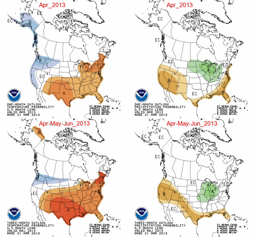
April Outllok
No good news in the April outlook for Utah with continued drier than normal weather expected. Temperatures in April are forecasted to be near normal for northwestern Utah and above normal for southeastern Utah.

Tuesday, March 19, 2013
Back to winter

Saturday, March 16, 2013
Quick small storm
A quick moving and small storm is expected to move through northern Utah on Sunday with a general 2-5" of snow above 7,000 ft for the Wasatch and Uinta mountains. Plan on a few rain changing to snow showers in the valleys with no accumulation. Click on the below picture for the model projected snow fall.


Wednesday, March 6, 2013
Mostly going south
A cold front is expected to move into Northern Utah this afternoon/tonight then stall over Salt Lake County and weaken as the main trough of low pressure moves through southern California/Arizona over the next several days. Most valleys in the state below 5,000 ft will see rain but watch for local Trace -1" of snow as low as the valley floor where the frontal band stalls tonight. By Saturday at 5pm plan on 2-4" mountain valleys, a general 3-8" for the Wasatch mountains above 7,000 ft, and 6-14" in the central and southern Utah mountains. See below for model projected snow fall through 5pm on Saturday.


Monday, March 4, 2013

Saturday, March 2, 2013
Valley rain and mountain snow
Look for a weak storm to move through the entire state on Sunday into Sunday night with valley rain and snow mainly above 6,500 ft. Plan on a general 3-8" of snow above 7,500 ft in the northern Utah mountains with 1-4" in the southern Utah mountains. See below for the model projected snow fall map.


Subscribe to:
Posts (Atom)